
Fresh Water Turning into Air: Alarming Satellite Images Reveal Crisis
Lake Pupi in the South American country of Bolivia is drying up. Photo: Al Jazeera.
Freshwater is vanishing into thin air. The very resource that humans, wildlife, and agriculture all depend on. This alarming reality has emerged from the World Bank's 2025 report.
According to the report, the world is losing 324 trillion litres of freshwater every year. This amount is enough to meet the annual demand of 280 million people.
This continuous decline in freshwater is known as "Continental Drying." It is being driven by intensifying droughts and unstable land and water management practices.
Al Jazeera has compiled data on ten lakes, rivers, and dams around the world that are rapidly losing water. The compilation reveals the true extent of this disappearance.
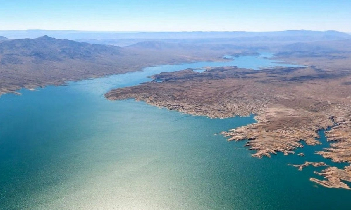
Lake Mead, USA. Collected photo.
Parana River
Stretching 4,900 kilometres, the Parana River is the second-longest river in South America and serves as a vital commercial waterway connecting Brazil, Paraguay, and Argentina. Satellite image analysis shows that water levels have dropped due to years of drought. This has reduced grain transport and hydroelectric power generation at the Itaipu Dam. Vast stretches of the riverbed have been exposed, and new islands have formed.
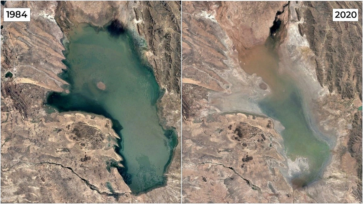
Lake Poopo, Bolivia
Located at an altitude of 3,700 metres in Bolivia, Lake Poopo is a stark example of near-extinction. Comparing satellite images from 1984 and 2020, the lake, which once spanned 1,000 square kilometres, has largely vanished. Changes in water flow, drought, and warming have turned it into a salt flat. Its fisheries have been destroyed, along with the livelihoods of the indigenous Uru people.
Lake Ngami, Botswana
In the southern African country of Botswana, Lake Ngami's condition depends on the inflow of water from the Okavango Delta. Due to severe drought and fluctuating upstream water flows, the lake had nearly disappeared at its lowest point. Productive fisheries and cattle grazing lands were destroyed. After turning into a cracked basin, it was partially restored. Satellite images from 1984 and 2020 capture this transformation.
Laguna de Aculeo, Chile
Located near Santiago, Chile, the Aculeo Lagoon has largely vanished in recent decades due to prolonged drought and water shortages. Comparing satellite images from 2007 and 2026 shows that this once-popular recreational area, which supported local communities, has almost completely dried up.
Lake Urmia, Iran
Located in northwestern Iran, Lake Urmia was once the largest saltwater lake in the Middle East. In 1990, the lake covered an area of 6,000 square kilometres. Today, its surface area has shrunk to just 581 square kilometres—merely 10 percent of its former size.
Prolonged droughts, excessive water usage for agriculture, altered river courses, and groundwater extraction have turned vast expanses of Lake Urmia into exposed salt flats.
Al-Chibayish Marshes, Iraq
Situated in southern Iraq, the Al-Chibayish Marshes are part of the larger Mesopotamian Marshes. Fed by the Tigris and Euphrates rivers, this UNESCO World Heritage site has undergone significant transformation, as seen in satellite images from 1984 and 2020.
In the 1990s, extensive drainage and severe drought caused widespread desiccation. However, in recent years, increased rainfall and various restoration efforts have helped bring some portions of the marshes back to a more natural state.
Ambovombe, Madagascar
The town of Ambovombe in southern Madagascar lies in one of the country's most climate-vulnerable and drought-prone regions. Satellite images from 1985 and 2020 reveal a severe environmental crisis unfolding in southern Madagascar, driven by years of drought and rising temperatures. Sandstorms and rainfall deficits have damaged water sources and agricultural land, disrupting both farming and livestock herding.
Lake Faguibine, Mali
Located on the edge of the Sahara Desert in northern Mali, Lake Faguibine has nearly disappeared in recent decades.
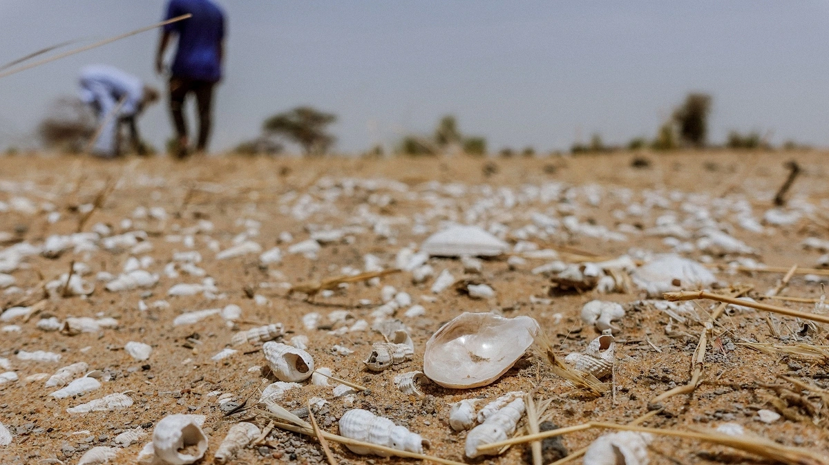
Photo Courtesy: Reuters.
The lake used to be replenished by seasonal flooding from the Niger River. However, satellite images from 1984 to 2020 show that reduced flood levels, persistent drought, and sediment buildup have caused the lake to shrink dramatically. Most of it has now dried up and is gradually being swallowed by the desert.
Lake Mead, United States
Located on the Nevada-Arizona border, Lake Mead is the largest reservoir in the United States by capacity. Formed in the 1930s by the construction of the Hoover Dam on the Colorado River, it serves as a vital water source for millions of people across the southwestern United States and parts of Mexico.
Comparing satellite images from 1984 and 2020 reveals a significant shrinkage of the reservoir. Prolonged drought, rising temperatures, and immense water demand have caused water levels to drop dramatically. Vast areas of the reservoir have dried up, turning into exposed flatlands.
South Aral Sea, Uzbekistan
Located in northwestern Uzbekistan, the South Aral Sea is part of one of the world's most severe human-made environmental disasters.
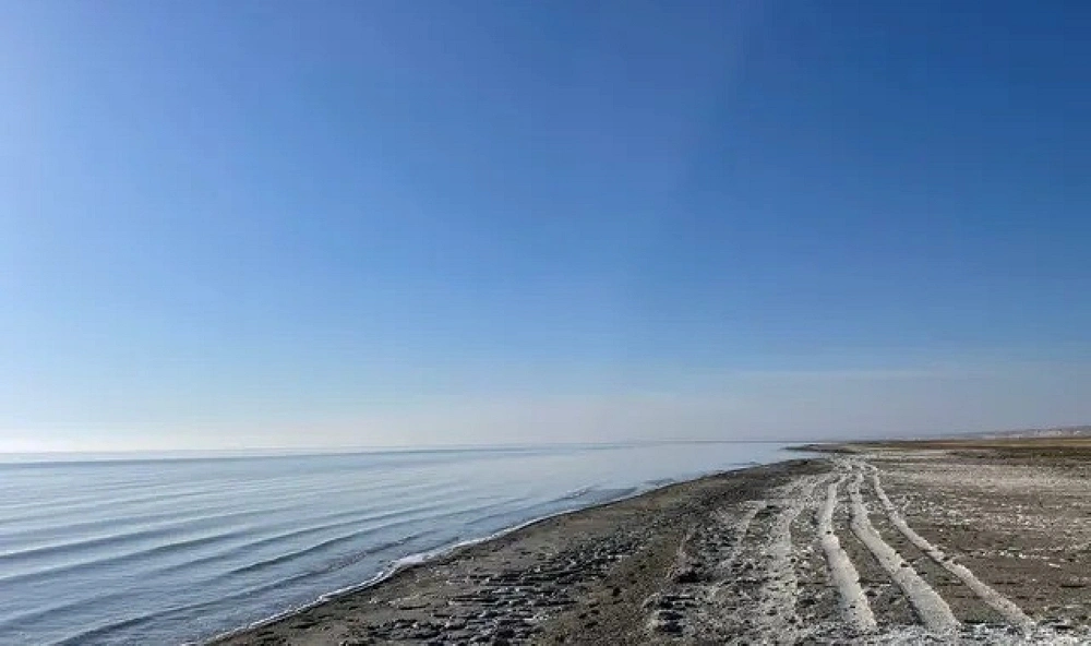
(Photo: Collected)
A comparison of satellite images from 1984 and 2020 shows the lake's dramatic disappearance. Over several decades, the diversion of rivers for irrigation has triggered one of the largest environmental catastrophes in the world. More than 90 percent of the lake has shrunk, leaving its vast exposed bed as a stark reminder of the devastation.

