
Severe Flooding Engulfs Texas as Flash Flood Risks Persist Across the South
Collected Photo
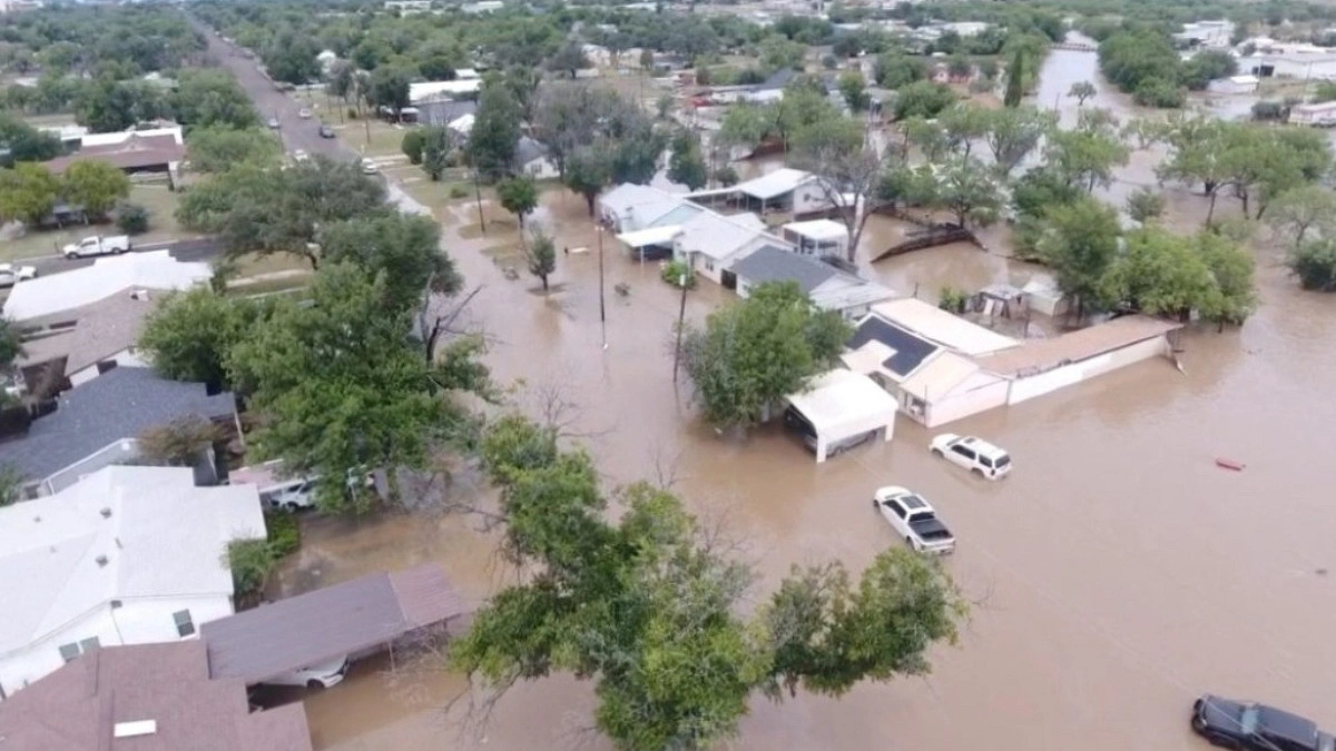
Parts of Texas, USA, are underwater this week after intense rainfall—ranging from 3 to more than 5 inches in just a few hours—triggered dangerous flash flooding. Hard-hit cities like Waco and Austin have seen roadways turn into rivers, with a flood watch remaining in effect across much of central and southern Texas.
In Waco, flash flooding along Interstate 35 led to multiple water rescues and left numerous vehicles stranded. The Texas Game Wardens reported on social media that their rescue teams, along with local partners, are responding to a high volume of emergency calls involving people trapped by rising floodwaters.
Dramatic videos from the area capture both the scale of the flooding and the efforts of first responders aiding stranded motorists.
"I am sincerely lucky to be alive. When I got there, there were no first responders," wrote Rick Smith, who filmed a video showing people wading through waist-deep water. "I am so thankful that retaining wall held up—otherwise this situation could've been a horrible tragedy. There were many of us literally trapped on I-35."
More Rain on the Horizon
A stalled frontal boundary stretching across the South is expected to bring daily flash flood risks throughout the coming week. A flood watch remains in effect for central and southern Texas, as well as much of Louisiana and southwest Mississippi, continuing through Tuesday evening or Wednesday morning depending on the location. Forecasters warn of torrential rainfall rates reaching 2 to 4 inches per hour.
Houston is facing a Level 3 out of 4 moderate risk for excessive rainfall and flash flooding for four consecutive days—Monday through Thursday. Significant flood events are possible each day.
Adding to the concern, a low-pressure system moving in from the Gulf of Mexico could bring even more rain to South Texas from mid to late week, raising the potential for further flooding.
Widespread Rainfall Expected
By Thursday, widespread rainfall totals of 4 to 6 inches are expected across southeast Texas, much of Louisiana, Mississippi, and Alabama. The Houston area and other isolated pockets of the South could see more than half a foot of rain. In a worst-case scenario, depending on weather patterns later in the week, five-day totals in the Houston region could exceed 10 inches.
Dangerous Heat Scorches the Pacific Northwest
Meanwhile, on the other side of the country, the Pacific Northwest is grappling with a dangerous heatwave. Record-high temperatures began in western Washington and Oregon on Sunday, with Seattle reaching a new record of 89°F and Portland hitting 94°F.
Monday could bring even more records, with temperatures nearing 100°F in Portland and climbing to around 90°F in Seattle. Residents are urged to stay hydrated, limit outdoor activity, and check on vulnerable neighbors.
Heat Peaks in Pacific Northwest Before Cooler Relief Arrives
An extreme heat warning remains in effect on Monday for Portland, while a heat advisory continues for Seattle. Residents in both cities are urged to take precautions as temperatures soar. However, relief is on the horizon: Tuesday and Wednesday will bring noticeably cooler conditions, with highs in the 70s for Seattle and the 80s for Portland.
Severe Storm Threat Rises Mid-Week
Shifting to the nation's midsection, Wednesday poses a significant severe weather threat. A Level 3 out of 5 enhanced risk has been issued from Missouri eastward through central Illinois and Indiana. Forecasters warn of destructive winds, large hail, and the possibility of strong tornadoes.
Major cities under this enhanced threat include Indianapolis, St. Louis, Springfield and Peoria in Illinois, and Columbia, Missouri.
A broader Level 2 out of 5 slight risk is in place for other key cities, including Chicago, Columbus, Kansas City, Wichita, and Toledo. Residents across these regions should remain weather-aware and have a plan in place should warnings be issued. (Source: abcnews)

