Nepal floods also ring alarm bells for India

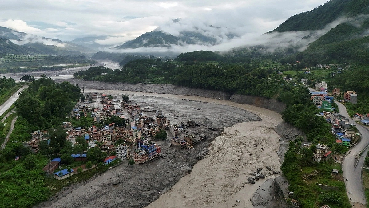
Picture: Reuters
The death toll from the devastating floods along the Nepal Tibet border has surpassed 1,000. But the impact of the disaster is not expected to remain confined to Nepal. It is also a major warning for India. According to a BBC report published Thursday, heavy rainfall in Nepal’s mountains, flash floods, landslides or glacier related disasters can have impacts that cross the border and reach vast areas of India’s plains.
Nepal has more than 6,000 rivers and streams. Most of them flow south into India and eventually join the Ganges basin. In the east there are the Kosi, in the central region the Gandaki and in the west the Karnali. Along the western border there is the Mahakali. Alongside these major rivers, smaller rivers such as the Bagmati, Kamla, Rapti and Babai can also quickly become dangerous during the monsoon. According to hydrologist Manish Shrestha of the International Centre for Integrated Mountain Development, seven to nine major rivers flowing from Nepal’s mountains into the plains of India are important for flooding in India. India’s Central Water Commission has also identified the Kosi, Gandaki, Bagmati and Ghaghara as major transboundary rivers.
Bihar is at the greatest risk. Nearly three quarters of northern Bihar is officially classified as flood prone. The Kosi, known as the “Sorrow of Bihar,” as well as major rivers such as the Gandak, Bagmati and Kamla originate in Nepal. Eastern Uttar Pradesh also experiences regular flooding due to the Ghaghara, Rapti and Gandak rivers. Areas such as Gorakhpur, Bahraich, Lakhimpur Kheri and Shravasti districts are particularly affected. North Bengal is also impacted by the flow of the Mechi and Mahananda rivers. According to ICIMOD hydrologist Pradeep Mani Dangol, Bihar is at the greatest risk in terms of scale, followed by Uttar Pradesh.
However, it is not that every flood in Nepal will cause a disaster of the same magnitude in India. The extent of the disaster depends on several factors, including where and how much rain has fallen in Nepal, how much sediment has accumulated in the rivers, the water level in India’s Ganges at the time, the condition of dams and the extent to which drainage systems are obstructed. The 2008 Kosi disaster is a major example. A dam breach in Nepal caused devastating floods in Bihar, killing around 400 people. According to IIT Kanpur professor Rajiv Sinha, the river at the time contained only about one tenth of the water capacity of the dam. In other words, the main cause of the disaster was not an unusually high flow of water but a weak and poorly maintained dam.
During normal monsoon conditions, floodwater can take around a day to travel from Nepal’s mountains to the plains of Bihar. But flash floods in the Chure hill region can reach the plains within just a few hours. During the recent disaster, the flood wave traveled from Rasuwa to Tribeni near the Indian border in only seven and a half hours.
An even greater concern is the changing nature of the Himalayas. In disasters such as the 2021 Chamoli incident and the 2025 Dharali disaster, water, ice, rocks and huge amounts of sediment combined to create devastating flows. Climate change is increasing extreme rainfall, while warming is causing more water vapor to accumulate in the atmosphere. The risks of melting permafrost, sudden drainage of glacial lakes and rock and ice avalanches are also increasing.