Why Nepal is so vulnerable to landslides, floods

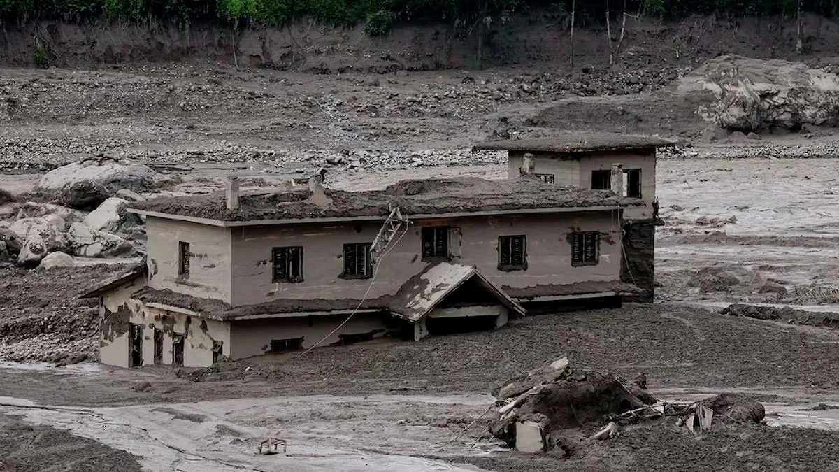
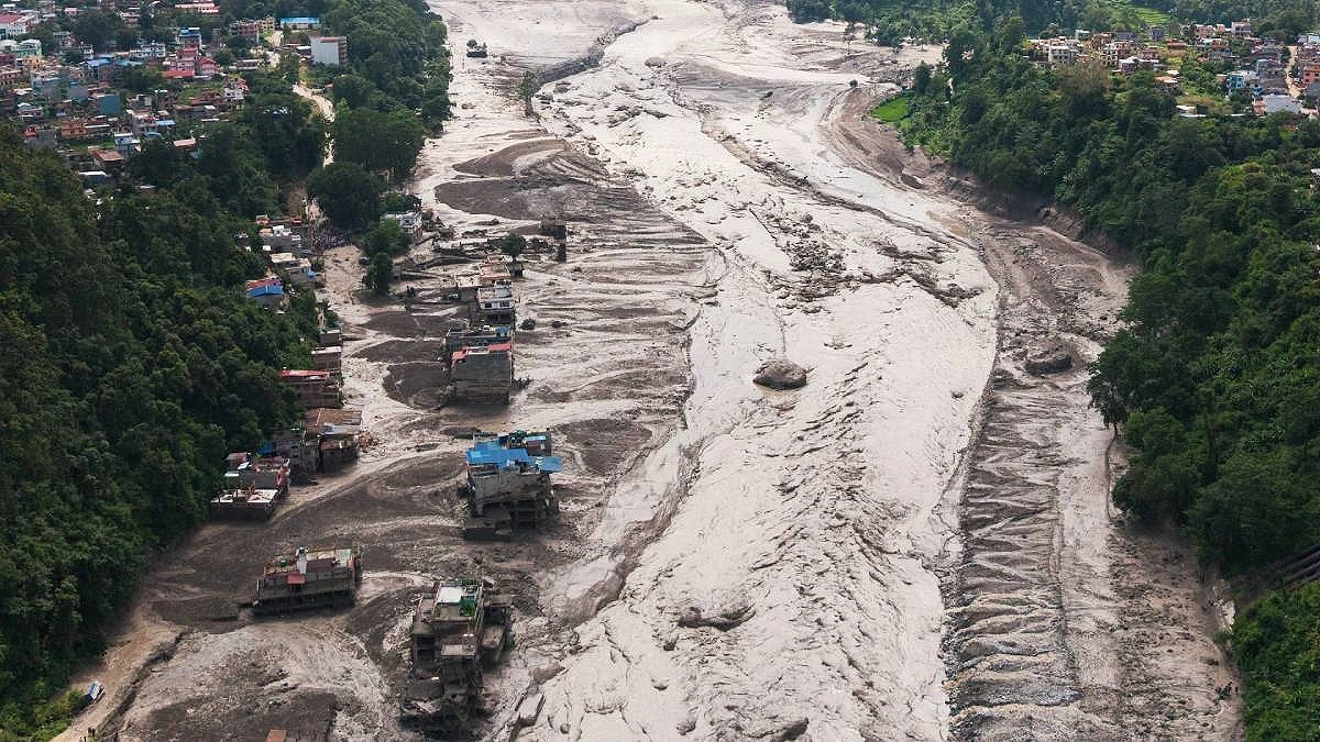
A massive surge of water suddenly rushed down the Koshi River in Nepal's Rasuwa district early yesterday, Wednesday. A structure that sustained extensive damage is visible. Photo: Reuters
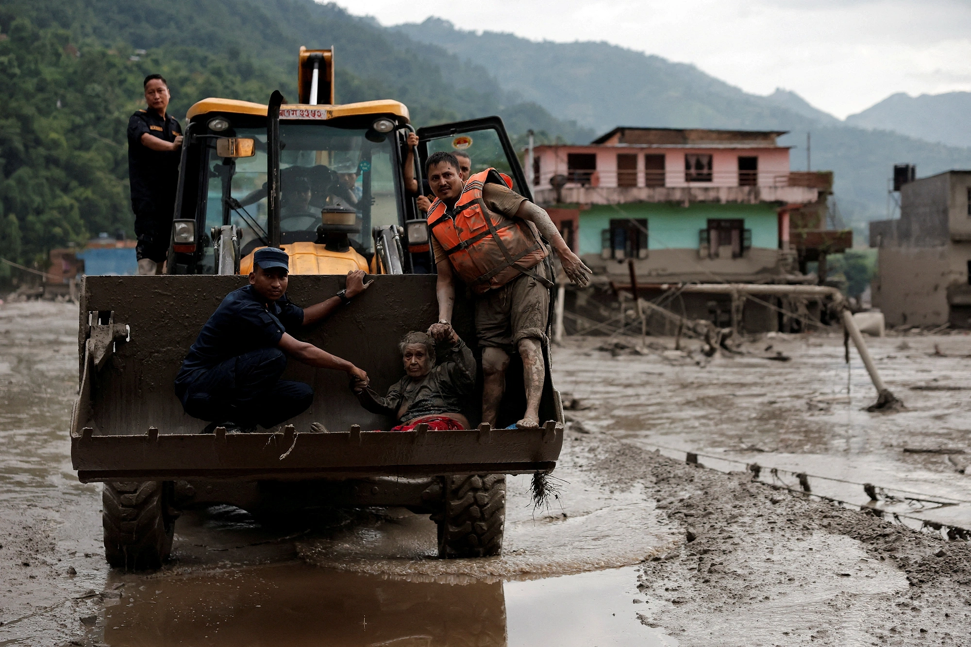
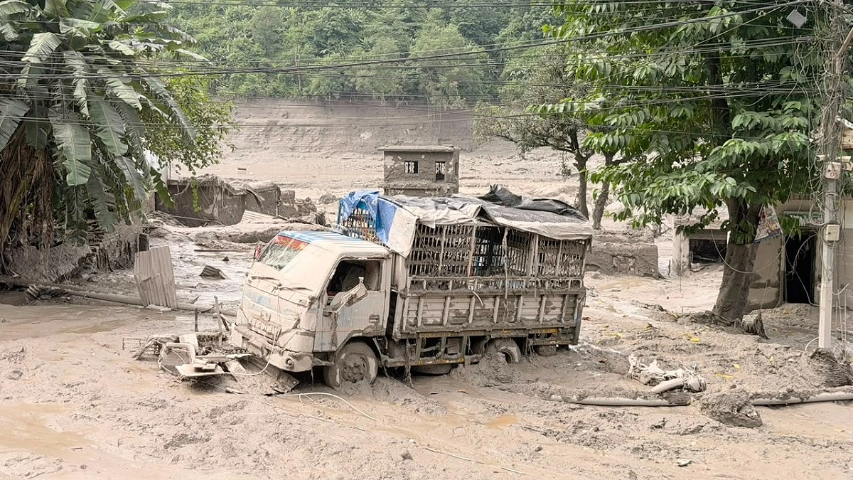
A sudden, massive wall of water surged down the Bhotekoshi River in Nepal's Rasuwa district on Wednesday morning, sweeping away settlements along the border. The floodwaters later cascaded into the Trishuli River, compounding the destruction.
According to the latest figures, at least 162 people have lost their lives in Nepal, while approximately 579 remain missing. Across the border in Tibet, three deaths have been reported, with another 558 people unaccounted for.
Nepal's disaster management agencies have noted that this is the second most severe flood along the 30-kilometre river stretch in just 13 months.
However, Wednesday's catastrophe was not merely a freak weather event. It was the result of two converging processes. First, the Himalayas are warming rapidly. As glaciers melt, water accumulates in places where it cannot be easily contained. Second, the Himalayan range is still actively forming—the Indian and Eurasian tectonic plates continue to collide, gradually pushing the mountains higher. This geological instability makes Nepal exceptionally prone to disasters.
Three Theories, One Common Thread
So far, three explanations have emerged regarding how the disaster unfolded. Foreign Minister Shisir Khanal told Parliament that a major landslide occurred following an earthquake at 8:37 am local time, which blocked the river's flow. When the blockage gave way, a torrent of water rushed downstream.
The US Geological Survey (USGS) detected a magnitude 4.4 tremor at that time. However, the agency later clarified that the seismic signal was caused by the landslide itself, not by an earthquake.
Scientists at the International Centre for Integrated Mountain Development (ICIMOD) have offered a similar explanation. Glaciologist Shashwat Sanyal suggested that the most severe flooding occurred on the Lhende Khola, a tributary of the Bhotekoshi. A massive collapse of ice and rock from a glacier dammed the river. Water pooled behind the blockage until the pressure became too great, releasing a violent surge downstream.
Rijan Bhakta Kayastha, a glaciologist and head of the Environmental Science Department at Kathmandu University, has echoed this view. "The Lhende Khola was blocked by a similar event last year as well. Satellite images from August 24 are now being re-examined," he said, following discussions with Nepali and Chinese scientists.
While the three explanations vary in detail, they all point to the same underlying mechanism: the river was dammed somewhere in the Himalayas, water accumulated behind the obstruction, and when the dam burst, a colossal flood was unleashed in an instant.
Destruction at the Border
The full force of the flood was witnessed at Rasuwagadhi, a key border crossing between Nepal and China's Tibet Autonomous Region. A bridge serving as the main entry point along the China-Nepal border was swept away by the raging waters. Authorities fear that dozens of people may have lost their lives in that area alone.
Why Nepal Is Especially Vulnerable to Glacial Lake Outburst Floods
Nepal is particularly susceptible to glacial lake outburst floods (GLOFs)—a phenomenon often described as "internal tsunamis."
Recent research by the International Centre for Integrated Mountain Development (ICIMOD) shows that the rate of glacial melt in the Hindu Kush Himalayan region has doubled since 2000. This has increased the risk for an estimated 2 million people living downstream of glacier-fed rivers.
Such disasters, however, are not new. Last year's flood in the same area was also linked to water released from a glacial lake in Tibet. Much earlier, in July 1981, a lake in Tibet's Zhangzangbo valley suddenly burst, killing more than 200 people, destroying the Friendship Bridge, and damaging the Sun Kosi hydropower plant.
According to the World Bank, Nepal's history records at least 24 major flood events of this kind—14 originating within Nepal and 10 from Tibet.
The cause of last year's July 8 flood later became clearer. An analysis by the US-based Stimson Centre found that a lake formed atop a glacier at an altitude of about 5,150 metres, roughly 35 kilometres from the border, had suddenly released its water.
As glaciers melt, hundreds of such lakes are forming on mountain slopes. Predicting exactly when, where, and how their water will break out is not always possible.
According to the United Nations Development Programme (UNDP), its 2020 inventory listed 3,624 glacial lakes across the Koshi, Gandaki, and Karnali basins. Of these, 47 were identified as potentially dangerous—25 in Tibet, 21 in Nepal, and one in India.
Another major factor compounding the risk is the lack of early warning. After the July 2025 disaster, the director general of Nepal's Department of Hydrology and Meteorology admitted that Nepal had no system for receiving data from the Tibetan region. While China does share some rainfall forecasts, glacial lake outburst floods do not depend on rainfall.
In 2025, Nepali officials said they received news of the flood about an hour before it crossed into Nepal—but that alert did not come through any formal early-warning system.
Since then, the Nepali government has decided to work with China on early warning and preparedness. In July of the same year, the UN's Green Climate Fund approved a grant of approximately $36 million for Nepal. Yet, an effective real-time warning system has still not been established on either side of the border.
A Deeper Geological Reality
Nepal's vulnerability also runs much deeper. The country sits at the collision zone of the Indian and Eurasian tectonic plates. These two plates are moving toward each other at a rate of about 20–21 millimetres per year. It was this collision that began creating the Himalayas some 50 million years ago.
That process is still ongoing. The Himalayas are among the youngest and fastest-growing mountain ranges on Earth, rising by about 5 millimetres each year.
This sustained geological pressure generates earthquakes. Large quakes weaken mountain slopes, but even smaller tremors can dislodge already unstable hillsides. What happened on Wednesday may well be a case in point—the seismic signal detected may not have been an earthquake at all, but rather the vibration from a massive landslide that blocked a river. When that blockage later gave way, a sudden flood was unleashed.
Research indicates that such outburst floods threaten approximately 103 kilometres of highways, 103 bridges, two major ports, and 3,301 buildings across China and Nepal.
Source: NDTV